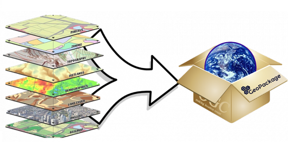
A GeoPackage (GPKG) is a data format for geographic information system implemented as a SQLite database container.
With the latest Update, it is now possible in OCAD in a test version to import point, linestring and polygons from GeoPackage. We are grateful for feedback.
In OCAD you can add raster logos in the Layoutmenu or you can import a vector PDF file.
Add raster logos
Raster logos can now be embedded directly in the OCAD file instead of just linking to the original file.
Embed: By embedding the raster images directly in the OCAD file, the file size increases accordingly. However, when passing on OCAD files, it is no longer necessary to ensure that the layout images are also supplied and saved in the correct folder.
Link: If your map contains layout images and you pass your file forward to another person, you need to ensure that the layout images are also supplied and saved in the correct folder, as they are not part of the OCAD file.
You can also select a linked image in the Layout object list and the Convert button becomes active. Press the Convert button and the selected image will be embedded.
In the best case the images are available as .png or.jpg files. Supported image files are also .bmp and .gif. Tiff files can be linked, but not embedded.
If there are only few and distinct colors with no color gradient, e.g. OCAD logo, the .png file is the best choice. Please note that PNG transparency is not supported. Save the logo as .jpg file if there are color gradients, e.g. IOF World Cup logo.
OCAD logo and IOF World Cup logo
The color model for layout images in OCAD is RGB. If you add raster logos, that are saved as CMKY logos, OCAD will convert the colors.
Make sure the raster images are not unnecessarily too large (e.g. some MB size). In this case, resampling before adding is recommended (e.g. in Paint or IrfanView).
It is also possible to import logos in vector PDF format. In this case OCAD creates Image objects, which have the correct CMYK color values and can be scaled arbitrarily.
OCAD licenses can be purchased as Single User or Team licenses.
What is the difference? How can the licenses be used?
Single User license
Single User licenses are suitable for individual users who want to work on multiple devices.
The user of a Single User license can install the software on 1 device by default. In order to allow the use on several own devices at the same time (e.g. desktop pc, laptop, tablet for field work), further activations for own devices will be granted by OCAD on request. Please contact info@ocad.com in this case.
Team license
Team licenses are suitable for clubs and organizations where many users work with OCAD.
Unlike Single User licenses, a Team license can only be activated on one device at a time, but the users can transfer their license immediately and at any time to another person.
The terms WMS and WMTS may sound scary to people who are not very familiar with computers. But no worries: It’s pretty easy to use them and knowing their strengths is of great advantage for mapping and even for course setting.
So, what exactly is WMS and WMTS?
WMS (Web Map Service) and WMTS (Web Map Tile Service) are interfaces for retrieving geodata as raster data over the internet. More and more of these services are available today.
A WMS is calculated on the server side and delivers one image per request.
A WMTS delivers tiles that have been pre-renderd on the server side, and cached on the client side. This will reduce waiting time for the data and bandwith.
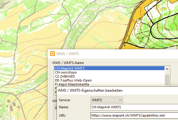
In OCAD, you can load WMS/WMTS as a background map. To do so, choose the WMS / WMTS command from the Background Map menu.
Typical layers are e.g. official cadastral surveys, topographic maps, aerial images, but also protected areas or forest reserves. All these data can contain useful information for your map project.
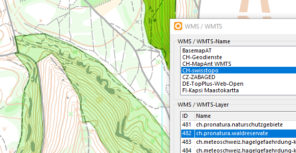
Therefore, you can easily update maps or add additional information to it with WMS/WMTS. In the example below, we connected a WMS from swisstopo and displayed a layer to show Forest Reserve Areas on a map.
Also, you can set courses on a WMS / WMTS layer. A step-by-step guide can be found in our OCAD Wiki.