Monthly Archives: August 2019

Check Legibility of Orienteering Maps

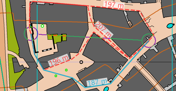
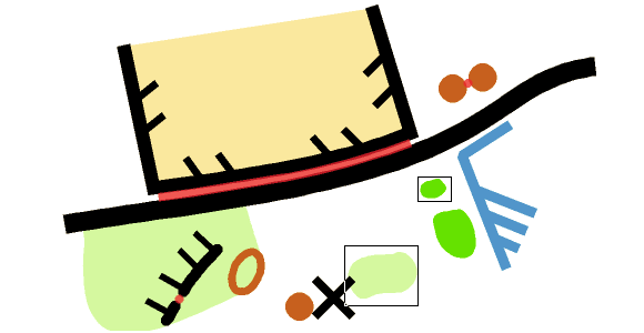
Nowadays, when mapping with high resolution and accurate base maps, the temptation is great to draw too many and too small objects. This may result in a poorly readable map.

The function Check Legibility veryfies minimum distances between objects, minimum length of line objects or minimum size of area objects according to ISOM 2017.

This will help map makers to find the right degree of generalisation and make the maps better readable. Furthremore, Event Advisers and Map Consultants have a tool to check the maps.

CheckLegibility

Short video about the function on YouTube.
More information on our OCAD Wiki.

OCAD Route Analyzer at Swiss Orienteering Week in Gstaad

Route Analyzer is the latest function for sprint maps in OCAD 2019. It analyses the shortest route and alternative routes of all legs. We have analysed and printed the shortest routes of the 1st SOW stage in Gstaad for all categories. 

Visit either our website www.ocad.com/sow2019 or pick up your printed sprint map with the shortest route and alternatives at the OCAD booth in the finish arena in Gstaad after the last start around 13:00.

We are looking forward to welcoming you at the OCAD booth starting at 9:00. We will be happy to demonstrate how the Route Analyzer works or how OCAD has evolved in the 30 years since the very first OCAD O-map of Schneitwald was published in spring 1989.

Link to SOW 2019 in Gstaad