There is a new features available in the current version of OCAD. You can create a new orienteering map based on open street map data.
Click on File -> New Map Wizard. A dialog appears. Choose ISOM 2017, set the scale and click on the button with the three dots to choose a filename. Click Next.
Enter a name of a town in the search field and click on Go. Move the map to the center to choose the right area. Change the coordinate system in the bottom.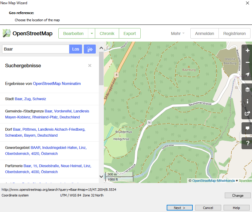 Click on Next.
Change the .crt file to ‘OSM to ISOM 2017.crt’. 
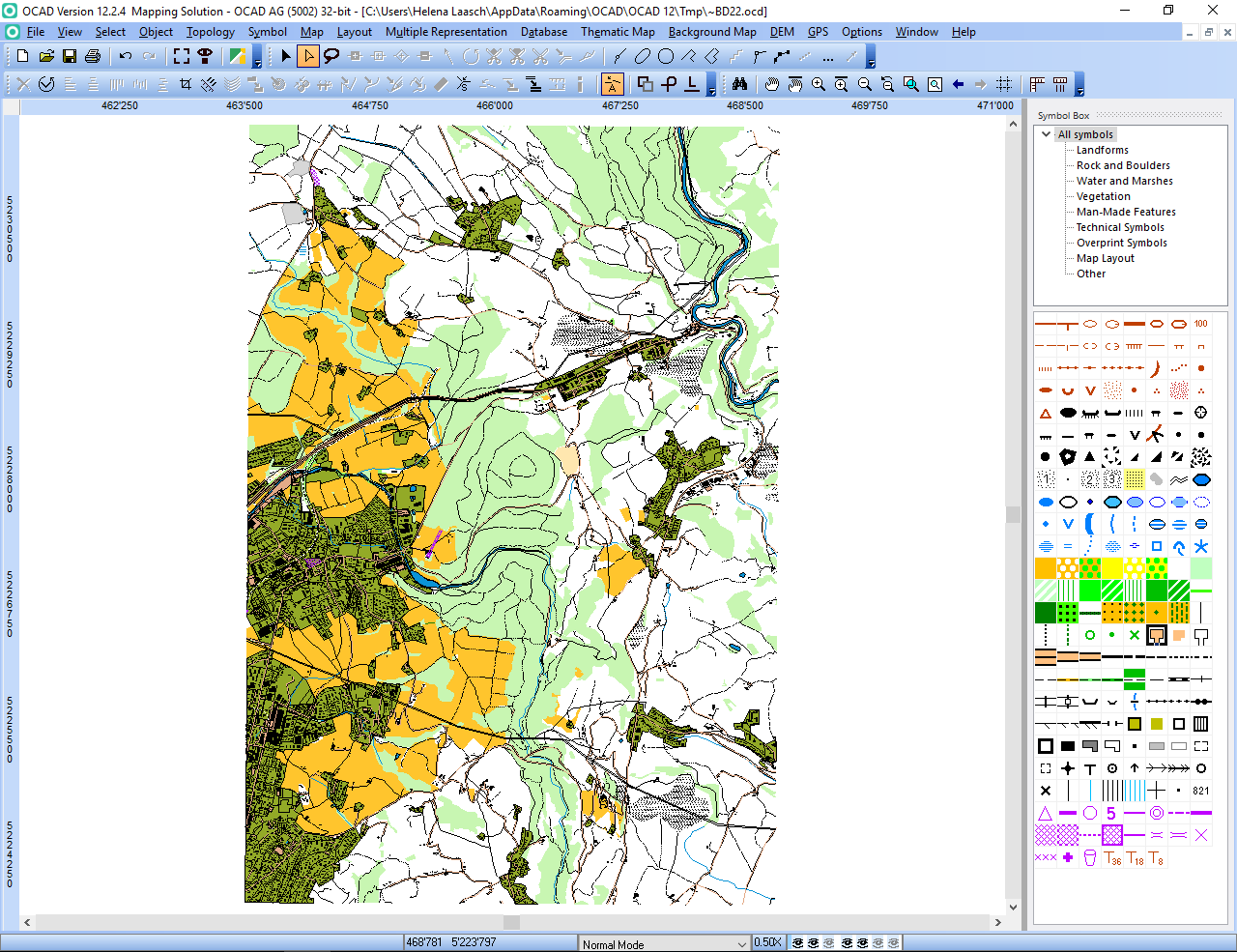
Wait a few minutes and you will get shown the imported OpenStreetMap data with ISOM 2017 symbols. Perhaps you have to delete some huge areas that cover the entire map.