One year ago, MapAnt elated the orienteering community by releasing a gigantic automatically generated orienteering map, covering almost every part of Finland. From December 2017 onwards the MapAnt-map can be accessed via WMTS and WMS. OCAD pre-configured the MapAnt WMS in its latest service update. Like this it’s very easy to extend an existing orienteering map.
Requirements
Your OCAD map needs to be georeferenced in the Finnish coordinate system TM35FIN.

Access WMS
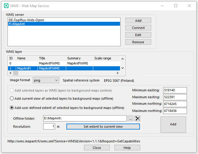
Open WMS – Web Map Service in the Background Map menu. Choose the pre-configured FI-MapAnt WMS and click on Connect.
The map tiles can be downloaded in png format to your local machine. Change the offline folder as needed and set the resolution to 1m.
Define the desired extend by inserting coordinates or simply zoom to the desired area and the click on Set extend to current view.
Click on Add. OCAD downloads the map tiles to your folder and load them directly as background maps.
Overlapping parts
Depending on the chosen extend, the background maps may overlap with your existing map. To avoid overlapping, following suggestions may help you:
- Fit the extend you want to download to the edges of your existing map
- Cover your entire orienteering map with white background. Add a new white color at the end of your color table which you use as fill color for a new area symbol. Set your View to Normal Mode.
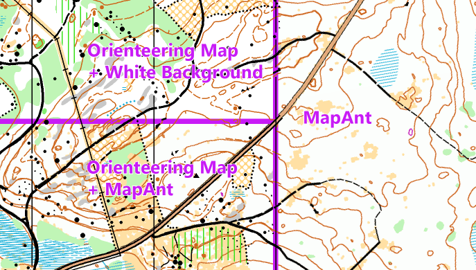
Orienteering map Luotosenjärvi Hamina by Janne Weckmann.
Link: http://www.mapant.fi/