SAS.Planet is a free application used to view and download satellite images submitted by such services as Google Maps, Bing Maps, Yandex.maps, Yahoo! Maps and many more.
The satellite images can be downloaded and then loaded into OCAD as georeferenced background maps.
We can recommend the following workaround:
1. Download SAS.Planet from the web and run the application.
2. Zoom to your desired location and select an extend.

3. Open the Selection Manager and edit the tab Stitch. Don’t forget to create a file for georeferencing. We’ve chosen the settings as follows.

4. Start the download.
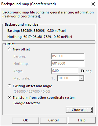
5. Open a map project in OCAD. Your map needs to be georeferenced. To georeference a new map, you can use the New Map Wizard.
6. Go to Menu Background>Manage>Open.
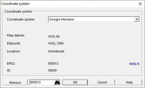
7. Choose your downloaded satellite images. As they most probably do not have the same coordinate system as your map project, you need to transform the satellite images. Choose Google Mercator as coordinate system.
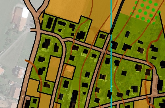
8. Click OK and the satellite images appear as georeferenced background maps.