Tag Archives: Starter

One-Click Map on a new level

For many years, a vision of OCAD has been to create a usable orienteering map with just one click.

With the latest OCAD Update we have come a step closer to our vision.

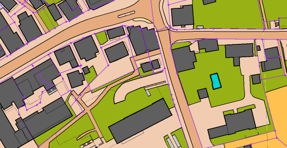
Thanks to freely accessible geodata, excellent maps for Switzerland and Finland can be created with the New Map Wizard. The trend towards freely available geodata can also be observed in other countries and we hope to be able to include these countries in the function as well in near future.

Video examples:

More information is available in the OCAD Wiki. The whole auto-generated Jukola 2020 Map Rovaniemi can be downloaded here.

Note: The geodata import for Finland and Switzerland is still a Beta version. Feedback is welcome.

Extract of auto-generated map from Jukola 2020 in Rovaniemi.
Extract from auto-generated sprint map of Baar.

OCAD 2018 becomes OCAD 2019

OCAD 2019 is just a new name to underline that you are using a software that is constantly evolving and which contains new features and standards. It’s not a new version. If you are on a subscription model, you will automatically receive OCAD 2019 with the latest Service Update and do not need to purchase any new licenses.

For technical reasons, OCAD installation folders, etc., will continue to be marked as OCAD 2018. However, the general strategy is to omit the year in the name of each OCAD edition in the future.

OCAD2019 Splashes