Tag Archives: XML Scripts

MapAnt Switzerland

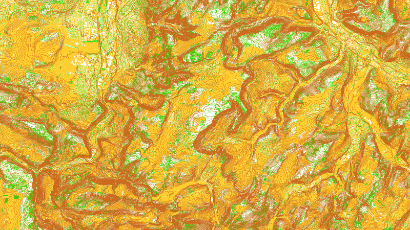
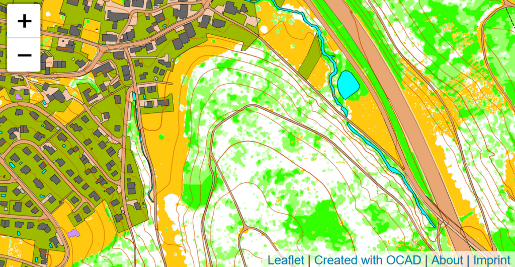
After the release of a pilot project for a Swiss MapAnt last summer, we are happy to present our final MapAnt Switzerland, which covers the whole of Switzerland.

The creation of this map became possible after the Federal Office of Topography swisstopo made many of its data available online free of charge as Open Government Data (OGD) this March.

MapAnt can animate to discover new areas. However, please note, that the possession of this map does not entitle to any orienteering activities in the terrain. Before using this map in the terrain, it is mandatory to contact the local orienteering club or the regional orienteering association to clarify forest use, private property, nature reserves, wildlife reserves, protected areas and other restrictions.

You can find more information about the development of MapAnt in our OCAD Wiki.

Have fun exploring Switzerland digitally!

How to process large amounts of LiDAR data

LiDAR data are invaluable for mapping, as highly accurate contour lines and base maps can be created.

But when processing LiDAR data for larger areas, a computer can quickly become overloaded because not enough RAM is available and crashes.

To avoid this, you have to work with XML scripts for larger projects. This may seem complicated at first glance, but don’t worry: All you have to do is copy code and make some adjustments.

This is what you need to do:

  1. Download and unzip our folder structure in your chosen directory.
  2. Create a new OCAD File with the desired symbol set, map scale and georeferencing. The New Map Wizard can help you with that.
    Save this file as Template.ocd (means overwrite the Template.ocd file in the folder structure).
  3. Put your LiDAR files in the folder 0_LAZ.
  4. Open the XML_Script.xml file with a text editor and adjust the file pathes in the document.
  5. In the OCAD File menu, go to Execute XML Script and run the script.

The script imports LiDAR data and creates contour lines and a vegetation base map.
The single tiles are calculated separately and then cropped and merged together in the end.

The XML function for importing las/laz files and creating contour lines and vegetation map is also available in the OCAD Orienteering edition.

Find more about XML on our Wiki:
XML Script an LiDAR
XML Script in general

MapAnt Switzerland is Online

MapAnt Switzerland is an automatically generated orienteering map that should cover the whole of Switzerland in the near future. As a pilot project, the region of north-western Switzerland was calculated. To map all parts of Switzerland, we depend on free and freely available LiDAR data, which are not yet available in all cantons. However, this should be the case in near future.

The map tiles were created in OCAD. Contour lines and a vegetation map were derived from LiDAR data. Also, data from the official cadastral survey were imported and converted into OCAD symbols. Afterwards, WMTS tiles were exported and made available on the web with leaflet.

More about the MapAnt Switzerland project can be found in our Wiki.

Credits: MapAnt Switzerland was inspired by various similar projects worldwide and got financial support by OL Gönnerclub. Thanks a lot!

OCAD ThematicMapper «Prix Carto» Newsletter

OCAD ThematicMapper «Prix Carto» Newsletter is also available as a PDF document:
https://www.ocad.com/newsletter/OCAD_newsletter_2015-12.pdf

Please exceuse the missing link in the newsletter for the video about creating thematic maps with OCAD XML Scripts:

Create Thematic Maps with OCAD ThematicMapper

Create Thematic Maps with OCAD ThematicMapper and XML Scripts