DEM data are sometimes in another coordinate system than the map. The newest OCAD 11 Service Update provides a new function to transform DEM data during the DEM import.
In this example the map file with the loaded orthophoto has the UTM Zone 18 North coordinate system, but the Lidar data are only available in US State Plane New York Long Island (US Feet).
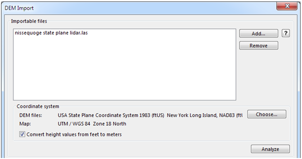
DEM import dialog
Click the Choose button in the DEM Import dialog to choose the coordinate system of the DEM file and check the option Convert height values from feet to meters. Click Analyze.
OCAD transforms all data points during the analysis procedure.
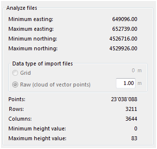
DEM file information
The minimum and maximum easting and northing values are now already in the map coordinate system UTM Zone 18 North. OCAD also converts the height values from feet to meters.
Click Save to import the DEM and save it.
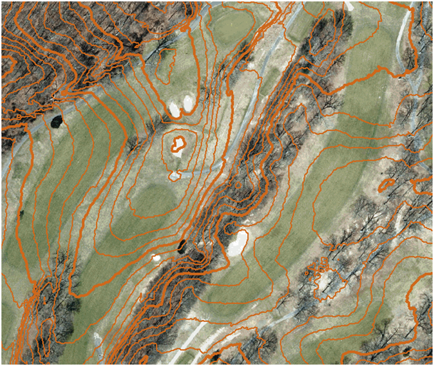
Result: The calculated contour lines from the DEM fit with the loaded orthophoto.
Thanks to Ed Hicks, Orienteering Unlimited, Inc. for providing the test data.