A new function has been added to the latest OCAD 2018 Service Update: Vectorize automatically cliff features.
With OCAD, you can now automatically convert cliff features from the Slope Gradient calculation into vector symbols.
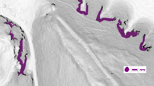
Please find more information in our Wiki.
To use this function, you need the latest OCAD 2018 Service Update, which can be downloaded from the Help -> OCAD Service Update function in the OCAD program.
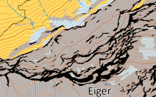
Is it possible for you to draw a sample map of the cliffs, which are drawn the same way as Swiss Topo?
Can you use Ocad to make the above map of Eiger look like a Swiss Topo of Eiger? The contour colors must be changed, parts deleted to white, and the mountain must be drawn by hand with a pen. IS it possible?
Hi
Thanks for the question.
Drawing the rocks the same way as Swiss Topo is very complex and needs experience. The rocks of our map are automatically generated by help of the slope gradient. If you want the rock like on Swiss Topo map, you would need to create new line and area symbols in OCAD and draw them manually. It would be possible, but needs time and experience.
Colours of the contours could easily be changed. Cut them, where they hit rocks or glaciers and assign them to new contour symbols. But also here, there’s a lot manual work.
Thank You for the Answer. Swiss Topo will probably remain the only cartographers, who draw the rocks of mountians so beautifully. Maybe it is also possible to print an ocad map with WHITE cliff feautures, and then use a caligraphy pen to draw the cliffs like Swiss Topo. Then color photo copy. I will try a combination of your suggestion and caligraphy pens. Danke.