The newest OCAD Service Update 11.4.0 contains some patches and also new features.
LAZ File
A LAZ file is a compressed LAS file for airborne laser scanning data. OCAD 11 uses the free laszip tool from Martin Isenburg to decompress these files.
Use the full range of possibilities of the Lidar data in OCAD 11.
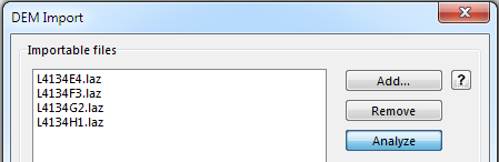
Import laz files.
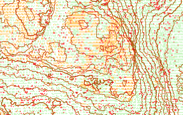
Calculated 1m contour lines with Lidar classification map
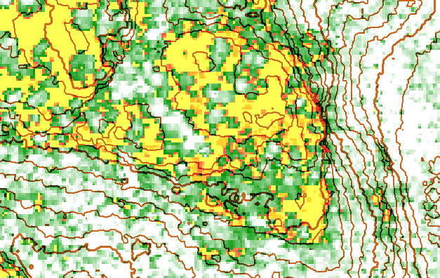
1m contour lines with vegetation height map
(yellow=open areas, green=low vegation, white= high vegetation)

1m contour lines with hill shading
GUI in Czech Language
Martin Simco, Machovsky mapy s.r.o. has translated OCAD 11 to Czech language. Many thanks to Martin.
Download OCAD 11.4.0 from our website, install it and use the new features or update to OCAD 11.