OCAD 2018 will be released soon. The Beta version is available for testing to all OCAD 12 users free of charge. Please visit our new OCAD 2018 Wiki how to download and install it.
Two of many new features available in the OCAD 2018 Beta version:
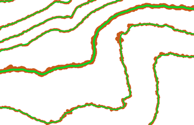
Stronger smoothing of contour lines in flat areas using the topographic position index (TPI).
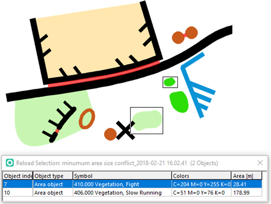
Checking the legibility of orienteering maps according ISOM 2017 (minimum distance between objects, minimum line length, minimum area size).
Despite new features, two major changes will be introduced with OCAD 2018:
1. Change to the Subscription Model
As the innovations and technological developments are having faster release processes it is no longer appropriate to release a new version of OCAD with many new features every three years. With regular updates, OCAD 2018 shall be updated with new functions, technological developments and new standards as soon as possible. By introducing the subscription model, you can purchase OCAD for one or three years.
2. Efficient and Carefree Team Work
Thanks to the subscription option “OCAD for Teams” you can transfer your license to others immediately. If you synchronize your OCAD file and installation with a cloud service (e. g. Dropbox, OneDrive etc.) you avoid compatibility problems between different OCAD versions, files and functionality. Everybody involved works with the same and most current version.
All you need to know about OCAD 2018, details on terms and the pricing can be found in our Frequently Asked Questions (FAQ).
For anyone who buys an OCAD 12 license during the Beta period you may choose an update to OCAD 2018 free of charge. The subscription will have a term of 3 years. After its expiration you decide to continue with an OCAD subscription or remain with OCAD 12.

Dear Ocad,
Nice to see that you implemented on which we invented and published 2016-17:
https://doi.org/10.1080/23729333.2017.1300998
Kettunen, P., Koski, C. and J. Oksanen, 2017. A design of contour generation for topographic maps with adaptive DEM smoothing. International Journal of Cartography 3(1): 19–30. DOI: 10.1080/23729333.2017.1300998