Using Airborne Laserscanning Data for Orienteering Base Map Generation
Jump to navigation
Jump to search
This tutorial shows how to generate in OCAD 12 an orienteering base map with the Airborne Laserscanning (ALS) test data from Landmäteriet in Sweden.
Link to the data: https://www.lantmateriet.se/Kartor-och-geografisk-information/Hojddata/Laserdata/Demodata/
Open New File
- File -> New -> Orienteering mao: Choose a file for orienteering maps.
- Save the create new file File -> Save
Import the Additional Symbol for the Contour Lines from ALS Data
- Press the Shift key and click File -> Import: OCAD opens the file chooser in Templates folder. Choose the file 'Template DEM Contour Lines.ocd'.
- In Import OCAD Map dialog choose the options Import all Symbols and colorsand Import colors at the top of the colors table. Click OK.
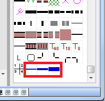
OCAD added 3 new symbol for the contour lines (1m, 5m, 25m) at the end of the symbol table.

