![]()
OCAD Newsletter - December 2022
English Version | Deutsche Version weiter unten
Grüezi XXXNAME
With this newsletter, OCAD Inc. provides information about its current products, activities, projects and events:
1. Win OCAD licenses
2. OCAD Sketch App Update 1.3.0
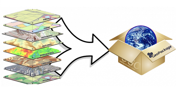
3. GeoPackage import in OCAD
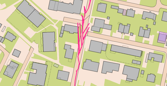
4. Check distance between contours
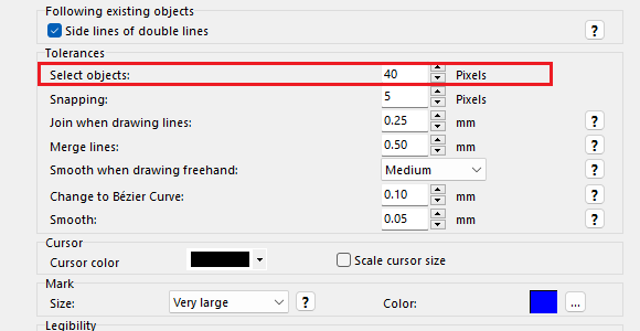
5. Higher tolerance on Windows tablets for object selection
6. OCAD at Kärtelertagung
7. OCAD Product Family