![]()
OCAD Newsletter - August 2020
English Version | Deutsche Version weiter unten
Grüezi XXXNAME
With this newsletter, OCAD Inc. provides information about its current products, activities, projects and events:
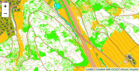
1. MapAnt Switzerland is Online
2. Upload Courses to SPORTident Center
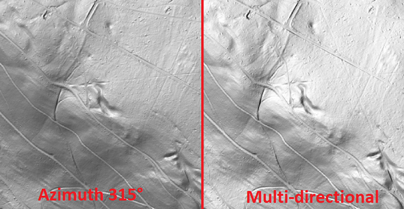
3. Multi-directional Hill Shading
4. Export of Geospatial PDF
5. OCAD Inc. at Fairs and Events
6. OCAD Product Family