Tag Archives: OCAD

OCAD at INTERGEO Digital

The next three days (13-15.10.2020), OCAD is present at INTERGEO, which is held completly digital this year.

Visit our digital booth or join us in our video room. Write an email to info@ocad.com if you need a free ticket. We would be happy to get in touch with you.

Especially for Intergeo, we have created a video presenting our company, products and services:

Link: https://youtu.be/KZemO2jJ7uY

Enjoy!

OCAD Survey

As OCAD team we pour our energy, heart and soul into the improvement and further development of OCAD. But are we on the right track? We are always open for feedback and the implementation of customer wishes.

That’s why we invite you to participate in our survey and state your opinion.

Go to the OCAD Survey

We would really appreciate your feedback. Thank you very much.

New Course Setting Functions

New functions for the OCAD Course Setting module have been added with the latest Service Update 18.2.2.

– With the Compose Course tool, course setting has become faster and easier. First click adds a start object, each additional click adds a control point and double click adds a finish object to the map and the course.

Compose Course

– To start successfully with a Course Setting project, we added the New Course Setting Project Wizard. This wizard guides you through the first steps, like choosing the right symbol set and loading a map file in the background layer.

The new functions will be explained briefly in this video.

New Course Setting Symbol Sets in OCAD

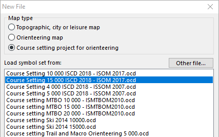
The International Orienteering Federation (IOF) Rules Commission released the updated IOF Control Descriptions (ISCD 2018) last week. The International Specification for Control Descriptions will come into force on 1st of January 2018. The new OCAD 12 Service Update 12.3.0 contains new course setting symbol sets which are fully compatible with the new ISCD 2018 specification.

Major Changes to the 2004 version

– Optional extra line showing the distance to the start triangle from the timed start.

– New symbols introduced for Trench and Out of Bounds Area.

– Bend moved from Column G to Column F.

– Removal of symbol for Radio or TV control.

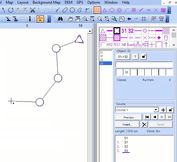
New Symbol Sets in OCAD

After installing the new OCAD 12 Service Update, the ISCD 2018 symbol sets for the different scales are available when starting a new Course Setting project.
In a course setting project for forest orienteering (scale 1:15’000 and 1:10’000) the course setting symbols refers to ISOM 2017, for sprint orienteering (scale 1:4’000 and 1:5’000) the course setting symbols refers to ISSOM 2007.
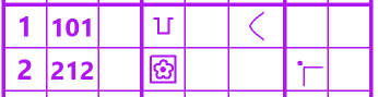
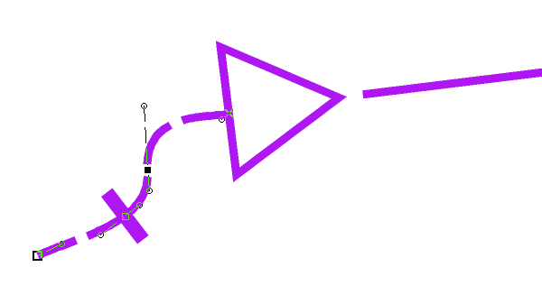
Map Issue Point

The International Specification for Orienteering Maps (ISOM 2017) has a new symbol for the map issue point (symbol number 702). How that works in OCAD? Choose a new ISCD 2018 course setting project and draw a marked route to the start triangle. Add a Corner Vertex into the dashed line. The crossbar for the map issue point appears.

Compatibility
Please note that the new symbol sets are not compatible with OCAD 11 and earlier versions.

Links:
OCAD Website: https://www.ocad.com/en/
IOF: http://orienteering.org/new-control-descriptions-published/
IOF ISOM 2017: http://orienteering.org/international-specification-for-orienteering-maps-isom-2017-has-been-published/

Open Street Map to ISOM 2017

There is a new features available in the current version of OCAD. You can create a new orienteering map based on open street map data.

Click on File -> New Map Wizard. A dialog appears. Choose ISOM 2017, set the scale and click on the button with the three dots to choose a filename.Click Next.

Enter a name of a town in the search field and click on Go. Move the map to the center to choose the right area. Change the coordinate system in the bottom.Click on Next.

Change the .crt file to ‘OSM to ISOM 2017.crt’. 

Wait a few minutes and you will get shown the imported OpenStreetMap data with ISOM 2017 symbols. Perhaps you have to delete some huge areas that cover the entire map.