Nicht kategorisierte Dateien
Zur Navigation springen
Zur Suche springen
Unten werden bis zu 250 Ergebnisse im Bereich 251 bis 500 angezeigt.
Zeige (vorherige 250 | nächste 250) (20 | 50 | 100 | 250 | 500)
 EisenbahnDoppellinie.png 449 × 426; 15 KB
 EisenbahnFreistellung.png 449 × 426; 11 KB
 EisenbahnHauptlinie.png 449 × 426; 16 KB
 EllipseTool.PNG 28 × 28; 557 Bytes
 EncryptedOCADFilePassword.PNG 417 × 181; 19 KB
 EndSymbol.PNG 643 × 291; 9 KB
 Ent40px.PNG 40 × 20; 700 Bytes
 EntireMap.JPG 27 × 26; 8 KB
 ErrorInDatabase1.png 654 × 573; 29 KB
 ErrorMessageBorlandEngineInstall.png 377 × 171; 20 KB
 ErrorMessageDbSysDbsLoadFieldsFromTable.png 367 × 161; 9 KB
 ErrorMessageMissingEtzw32dll.PNG 473 × 171; 19 KB
 ErrorMessageOCAD11BetaInstallation.png 478 × 171; 18 KB
 ErrorStringResource.PNG 342 × 171; 12 KB
 ErsterFreierCode.PNG 21 × 20; 375 Bytes
 Event.gif 24 × 24; 914 Bytes
 Example.jpg 17 × 17; 459 Bytes
 Export.PNG 247 × 199; 8 KB
 ExportCourseMaps.png 364 × 549; 26 KB
 ExportCourseMapsPlaceCoursesAtOriginalPosition.png 1.730 × 758; 448 KB
 ExportCourseMapsPlaceCoursesBelowEachOther.png 344 × 988; 186 KB
 ExportCourseMapsPlaceCoursesBesideEachOther.png 1.722 × 308; 221 KB
 ExportEncryptedFile.PNG 383 × 565; 29 KB
 ExportOim.png 251 × 190; 5 KB
 ExportOimAjaxError0.png 240 × 144; 1 KB
 ExportOimAssistant1General.png 642 × 515; 20 KB
 ExportOimAssistant2ZoomLevel.png 642 × 515; 25 KB
 ExportOimAssistant3Layout.png 642 × 515; 31 KB
 ExportOimAssistant4Pois.png 642 × 515; 23 KB
 ExportOimAssistant5PoiSelector1.png 336 × 266; 12 KB
 ExportOimAssistant5PoiSelector2.png 336 × 266; 12 KB
 ExportOimAssistant5PoiSelector3.png 336 × 266; 11 KB
 ExportOimAssistant5PoiSelector4.png 346 × 344; 18 KB
 FasterTextRendering.PNG 297 × 129; 5 KB
 FileErrorMessageOCAD11BetaInstallation.png 478 × 171; 18 KB
 FillTool.PNG 28 × 28; 590 Bytes
 FilledCircleTool.PNG 28 × 28; 507 Bytes
 FilledRectangleTool.PNG 28 × 28; 394 Bytes
 FindObjectDialog.PNG 306 × 151; 13 KB
 FindUTMZone.PNG 338 × 227; 22 KB
 Firstpoint.GIF 14 × 13; 845 Bytes
 Framecol.gif 194 × 53; 1 KB
 FramingModeLine.PNG 609 × 143; 8 KB
 FramingModeOff.PNG 609 × 61; 3 KB
 FramingModeShadow.PNG 609 × 71; 6 KB
 Freehand ExportPDF Settings.gif 251 × 427; 8 KB
 Freehand To Curve.PNG 461 × 189; 8 KB
 FullLine.PNG 624 × 39; 2 KB
 FullLine MainLine.PNG 505 × 484; 42 KB
 FullStopHelp.PNG 608 × 342; 11 KB
 Fullline.gif 289 × 13; 936 Bytes
 GIS AddTextsByRecords.PNG 531 × 446; 37 KB
 GIS AssignSymbolByRecords.PNG 459 × 437; 36 KB
 GIS ImportShapeFiles.PNG 575 × 723; 50 KB
 GIS Symbolsset.PNG 845 × 659; 39 KB
 GUI.JPG 1.000 × 707; 98 KB
 GenerateMapPreview.PNG 23 × 23; 3 KB
 Geolog.gif 296 × 48; 1 KB
 GeologicalLine.PNG 625 × 89; 5 KB
 GeologicalLine Decrease.PNG 496 × 482; 27 KB
 GeologicalLine Distances.PNG 503 × 471; 18 KB
 GeologicalLine SymbolEditorA.PNG 398 × 399; 10 KB
 GeologicalLine SymbolEditorB.PNG 401 × 398; 10 KB
 GeologicalLine Symbols.PNG 491 × 474; 32 KB
 GetObjects.PNG 876 × 675; 280 KB
 GetObjectsFromCurrentView.PNG 23 × 23; 3 KB
 GpsRealTimeThickerCursor.png 627 × 382; 19 KB
 Gradient.PNG 417 × 211; 18 KB
 GroupUngroup.png 447 × 133; 5 KB
 HTTP.png 397 × 115; 5 KB
 Hatch.PNG 406 × 365; 13 KB
 HatchAreas.PNG 1.068 × 814; 121 KB
 HatchAreasExample.PNG 1.024 × 125; 140 KB
 HatchExample.PNG 756 × 167; 6 KB
 HatchTip.PNG 533 × 321; 11 KB
 HeighOnASlope.PNG 109 × 67; 987 Bytes
 Help.gif 763 × 429; 24 KB
 Highway.PNG 808 × 135; 8 KB
 Highway DoubleLine.PNG 484 × 466; 31 KB
 Highway Framing.PNG 489 × 468; 26 KB
 Highway MainLine.PNG 499 × 479; 32 KB
 HillShading.PNG 1.020 × 560; 589 KB
 Hint.jpg 20 × 20; 15 KB
 HintergrundkarteOeffnenGeoreferenziert.png 471 × 499; 27 KB
 HoleWithOnlyTwoVertices.PNG 239 × 183; 3 KB
 HowTos.gif 465 × 360; 48 KB
 HypsometricMap.PNG 1.020 × 565; 226 KB
 IconEditor.JPG 521 × 422; 82 KB
 IconSmooth.PNG 24 × 24; 344 Bytes
 Icon AccuracyCircle.PNG 22 × 22; 344 Bytes
 Icon AddGPSPositionToCalculateAverage.PNG 22 × 22; 384 Bytes
 Icon AlignObjectsHorizontal.PNG 23 × 23; 3 KB
 Icon AlignObjectsVertical.PNG 23 × 23; 3 KB
 Icon AutomaticJoining.PNG 23 × 23; 4 KB
 Icon CSA Redo.PNG 22 × 22; 474 Bytes
 Icon CSA Undo.PNG 22 × 22; 479 Bytes
 Icon ChangeSymbolForAllObjectsWithThisSymbol.PNG 23 × 23; 4 KB
 Icon ChangeSymbolOfObject.PNG 23 × 23; 4 KB
 Icon ChangeToBezierCurve.PNG 23 × 23; 4 KB
 Icon ChangeToPolyline.png 23 × 23; 3 KB
 Icon CheckIn.PNG 22 × 22; 441 Bytes
 Icon CheckOut.PNG 22 × 22; 467 Bytes
 Icon CircleMode.PNG 23 × 23; 4 KB
 Icon ConnectDisconnect.PNG 22 × 22; 363 Bytes
 Icon ConvertToGraphicObject.PNG 23 × 23; 4 KB
 Icon CornerVertex.PNG 23 × 23; 4 KB
 Icon CurveMode.PNG 23 × 23; 4 KB
 Icon Cut.PNG 23 × 23; 4 KB
 Icon CutArea.PNG 23 × 23; 4 KB
 Icon CutHole.PNG 23 × 23; 4 KB
 Icon DashVertex.PNG 23 × 23; 4 KB
 Icon Delete.PNG 23 × 23; 4 KB
 Icon Delete2.PNG 23 × 24; 463 Bytes
 Icon DeleteObjectsInDatabase.PNG 22 × 22; 310 Bytes
 Icon DoDatabaseMaintenance.PNG 22 × 22; 597 Bytes
 Icon DrawingMultiplePointObjects.PNG 23 × 23; 3 KB
 Icon DuplicateObject.PNG 23 × 23; 4 KB
 Icon EllipseMode.PNG 23 × 23; 4 KB
 Icon FillOrMakeBorder.PNG 23 × 23; 4 KB
 Icon FindGPSMarker.PNG 22 × 22; 343 Bytes
 Icon FindSelectedObjects.PNG 23 × 23; 4 KB
 Icon FreehandMode.PNG 23 × 23; 4 KB
 Icon GPSFilter.PNG 22 × 22; 371 Bytes
 Icon GenerateMapPreview.PNG 22 × 22; 542 Bytes
 Icon GetObjectsFromCurrentView.PNG 22 × 22; 592 Bytes
 Icon ImportMap.PNG 22 × 22; 439 Bytes
 Icon IndicateDirectionOfAreaPatternPointOrTextObject.PNG 23 × 23; 4 KB
 Icon InterpolateObjects.PNG 23 × 23; 3 KB
 Icon Join.PNG 23 × 23; 3 KB
 Icon LaserDistance.PNG 23 × 23; 3 KB
 Icon ManageServerBookmarks.PNG 22 × 22; 378 Bytes
 Icon Measure.PNG 23 × 23; 4 KB
 Icon Merge.PNG 23 × 23; 4 KB
 Icon MoveParallel.PNG 23 × 23; 4 KB
 Icon New.PNG 23 × 23; 4 KB
 Icon NormalVertex.PNG 23 × 23; 4 KB
 Icon NumericMode.PNG 23 × 23; 3 KB
 Icon ObjectHistory.PNG 22 × 22; 381 Bytes
 Icon Open.PNG 23 × 23; 4 KB
 Icon OpenRealTimeGPSSettings.PNG 22 × 22; 246 Bytes
 Icon Pan.PNG 22 × 22; 4 KB
 Icon PanLocked.PNG 22 × 23; 4 KB
 Icon PauseGPSMeasurement.PNG 22 × 22; 266 Bytes
 Icon Print.PNG 23 × 23; 4 KB
 Icon RectangularLineMode.PNG 23 × 23; 4 KB
 Icon RectangularMode.PNG 23 × 23; 4 KB
 Icon Redo.PNG 23 × 23; 4 KB
 Icon RemoveVertex.PNG 23 × 23; 4 KB
 Icon Reshape.PNG 23 × 23; 4 KB
 Icon ReverseObject.PNG 23 × 23; 4 KB
 Icon RightsManagement.PNG 22 × 22; 643 Bytes
 Icon RotateEnterAngle.PNG 23 × 23; 3 KB
 Icon RotateObject.PNG 23 × 23; 4 KB
 Icon Save.PNG 23 × 23; 4 KB
 Icon SaveForOfflineWork.PNG 22 × 22; 630 Bytes
 Icon SelectAndEditObject.PNG 23 × 23; 3 KB
 Icon SelectObjectAndEditVertex.PNG 23 × 23; 4 KB
 Icon Setup.PNG 25 × 26; 398 Bytes
 Icon ShowCheckedOutObjects.PNG 22 × 22; 588 Bytes
 Icon ShowEntireMap.PNG 22 × 23; 4 KB
 Icon ShowGrid.PNG 23 × 23; 3 KB
 Icon ShowProjectInformation.PNG 22 × 22; 693 Bytes
 Icon Smooth.PNG 23 × 23; 4 KB
 Icon Snapping.PNG 23 × 23; 4 KB
 Icon StartGPSMeasurement.PNG 22 × 22; 299 Bytes
 Icon StopGPSMeasurement.PNG 22 × 22; 251 Bytes
 Icon StraightLineMode.PNG 23 × 23; 3 KB
 Icon Undo.PNG 23 × 23; 3 KB
 Icon ZoomIn.PNG 22 × 23; 4 KB
 Icon ZoomInLocked.PNG 22 × 23; 4 KB
 Icon ZoomOut.PNG 22 × 23; 4 KB
 Icon ZoomOutToPreviousView.PNG 22 × 23; 4 KB
 Icon ZoomToNextView.PNG 23 × 23; 3 KB
 Icon ZoomToPreviousView.PNG 22 × 23; 4 KB
 ImportFreehandXml.PNG 513 × 311; 28 KB
 ImportMapDialog.PNG 337 × 283; 19 KB
 ImportMaps.PNG 23 × 23; 3 KB
 ImportShapeFile.PNG 500 × 660; 29 KB
 ImportShapeText1.png 872 × 562; 111 KB
 ImportShapeText2.png 493 × 391; 28 KB
 ImportShapeText3.png 872 × 562; 106 KB
 IndentFirstLine.PNG 424 × 283; 11 KB
 IndentOtherLines.PNG 397 × 300; 12 KB
 Index1.gif 120 × 120; 10 KB
 Index2.gif 120 × 120; 12 KB
 Index3.gif 120 × 120; 11 KB
 Index4.gif 120 × 120; 10 KB
 IndicateDirectionofPattern.PNG 607 × 377; 12 KB
 InflectionPointOfBezierCurve.PNG 275 × 174; 9 KB
 InfluenceDashedNormal.PNG 191 × 74; 3 KB
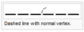
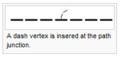 InfluenceDashedVertex.PNG 199 × 94; 4 KB
 InsertGlyphs.PNG 1.023 × 656; 60 KB
 InsertionLine.PNG 67 × 44; 490 Bytes
 Insertvar.gif 107 × 80; 1 KB
 InternalErrorReadXmlLicenseFile.png 486 × 161; 20 KB
 InternalErrorTOcdIsGridZoneValidUnknownGrid.png 436 × 171; 18 KB
 InterpolateLines.png 525 × 163; 24 KB
 InterpolatePoints.png 731 × 113; 16 KB
 Intersection.PNG 477 × 135; 21 KB
 InvalidExteriorRing.PNG 452 × 184; 7 KB
 Joining Lines.PNG 448 × 501; 8 KB
 KarteOptimierungErgebnis.png 387 × 269; 21 KB
 Kategorien.PNG 663 × 337; 26 KB
 Keyline.PNG 658 × 210; 32 KB
 KeylineExample.PNG 1.024 × 124; 126 KB
 Kindhausen.PNG 1.054 × 729; 50 KB
 Kindhausen01.PNG 920 × 686; 180 KB
 Kindhausen02.PNG 1.003 × 709; 504 KB
 Kindhausen03.PNG 997 × 712; 601 KB
 Kindhausen05.PNG 932 × 690; 83 KB
 Kindhausen ConvertImportedLayerToSymbols2.PNG 471 × 437; 30 KB
 Kindhausen CreateContourLines.PNG 632 × 293; 30 KB
 Kindhausen CreateHillShading.PNG 596 × 318; 28 KB
 Kindhausen DEMImport.PNG 479 × 631; 37 KB
 Kindhausen ImportFile.PNG 475 × 472; 36 KB
 LargeSquare.JPG 18 × 21; 8 KB
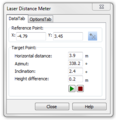 LaserDistanceMeterDataTab.PNG 295 × 305; 15 KB
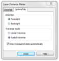 LaserDistanceMeterOptionTab.PNG 297 × 307; 16 KB
 LaserdistanzmessgerätDaten.png 267 × 278; 8 KB
 LaserdistanzmessgerätOptionen.png 267 × 278; 9 KB
 LaserdistanzmessgerätVerbinden.png 461 × 202; 15 KB
 LaserdistanzmessgerätVerbindenTesten.png 313 × 361; 13 KB
 LegVariation.PNG 907 × 643; 211 KB
 LegVariationSymbol.PNG 54 × 67; 492 Bytes
 LegVariationSymbol2.PNG 82 × 113; 1 KB
 LegVariationTable.PNG 375 × 115; 4 KB
 Legend VegetationHeight.PNG 142 × 182; 3 KB
 LineAppearanceAsOcad10Warnung.png 496 × 229; 23 KB
 LineAppearanceOcad10.png 862 × 460; 33 KB
 LineAppearanceOcad11.png 862 × 466; 31 KB
 LineLength.PNG 411 × 369; 8 KB
 LineSpacing.PNG 418 × 420; 23 KB
 LineStyle.PNG 386 × 574; 10 KB
 LineSymbol.JPG 468 × 445; 42 KB
 LineSymbolDistances.PNG 493 × 475; 39 KB
 LineTextSymbol.JPG 412 × 448; 36 KB
 LineTextSymbolGeneral.PNG 422 × 456; 25 KB
 LineTextSymbols.PNG 537 × 159; 9 KB
 LineTool.PNG 28 × 28; 567 Bytes
 Line Icon.PNG 27 × 27; 595 Bytes
 Linebtn.gif 23 × 22; 887 Bytes
 Linienobjekte.PNG 557 × 223; 19 KB
 LinientextObjekteVerlaengern.png 423 × 170; 9 KB
 LivePreview.PNG 658 × 210; 19 KB
 LoadObjectsFromSymbolTree.PNG 465 × 391; 26 KB
 LoadRasterMapDialog.PNG 345 × 361; 20 KB
 MacOSX1.PNG 1.440 × 900; 1,9 MB
 MacOSX3.PNG 1.440 × 900; 2,31 MB
 MacOSX4.PNG 1.440 × 900; 783 KB
 MacOSX5.PNG 1.440 × 900; 1,78 MB


Zeige (vorherige 250 | nächste 250) (20 | 50 | 100 | 250 | 500)