Tag Archives: OCAD 12 Orienteering

Get a free OCAD Starter License for World Orienteering Day

World Orienteering Day (WOD) is a project of the International Orienteering Federation to increase the visibility and accessibility of orienteering worldwide.

This year, between the dates May 17th and May 23rd 2023, any orienteering activity held can be registered as a World Orienteering Day event.

As in previous years, we provide free OCAD Starter licenses to draw orienteering maps and set courses for this event.

How to get a license:

  • Register a WOD event here
  • Send an email to wod@orienteering.sport and request a license
  • You will get the license information by email from WOD

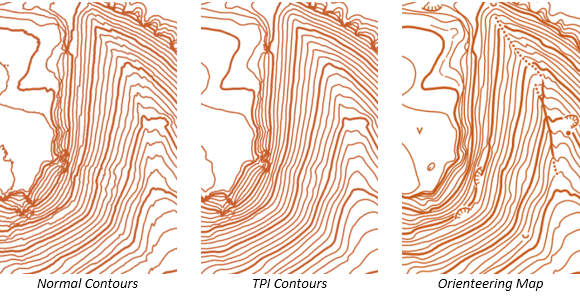
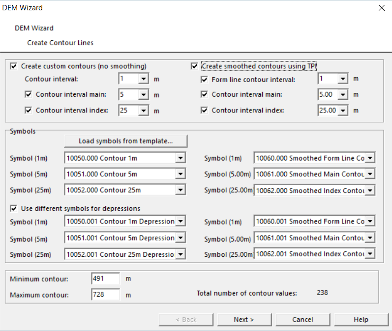
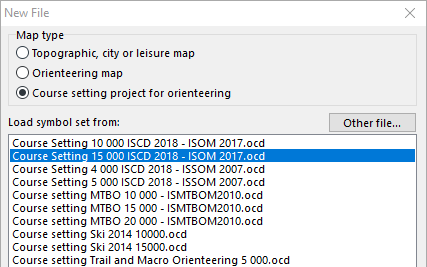
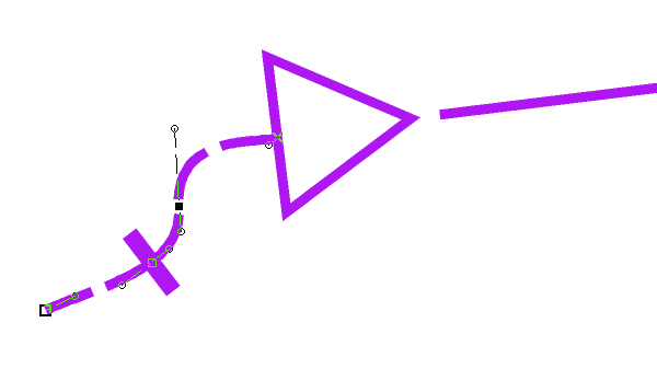
OCAD Starter does not only include the Course Setting Module, but also the New Map Wizard, with which you can create an orienteering map anywhere in the world with just a few clicks.

You can find out how to do so in our World Orienteering Day Tutorial.

Register now and become a part of WOD!

Run OCAD on Linux

OCAD is a Windows software. However, OCAD runs on Ubuntu using Wine.

We installed Wine on Ubuntu and run OCAD afterwards without any problems.

Wine is a free software and enables Linux users to run Windows applications without a copy of Microsoft Windows. Install Wine from the Ubuntu Software Center.

Create Smoothed Contours Using TPI

TPI stands for Topographic Position Index, which is defined as the difference between a central pixel and the mean of its surrounding cells. Choosing this option, OCAD first creates a smoothed DEM using TPI and calculates contours afterwards.

Some details may get lost, but results are very satisfying in constant slopes. Use these contours, if you want to adopt the calculated contour lines directly to your map.

In the DEM Wizard you can create “normal” custom contours (no smoothing) and/ or smoothed contours using TPI in one single step:

  • Choose the desired amount of contour and the interval.
  • Assign a line symbol for each type appears. By default, the first three line symbols in the settings are pre-selected.
  • Click on “Load symbols from template…” to get 12 line symbols at the bottom of your symbol box, which can be used for the settings.
  • Use different symbols for depression to distinguish depressions from hills.

As mentioned in the beginning, TPI contours were derived from a smoothed DEM, means some details will get lost. The following recommendations can be made:

  • For mapping in the terrain, use the custom contour lines as background, where you have all details on it.
  •  To draw contour lines on the PC, first calculate and load the TPI contours and adapt them afterwards where needed. Use the Reshape function for that.
    Especially in steep and constant slops, the biggest part of the TPI contours can be adopted to your map without redrawing. You gain much time like that.

For further information, please visit our Wiki.

IOF ISSOM 20XX Final Draft for Sprint Orienteering Maps Released

The international Orienteering Federation (IOF) published a final draft of the new International Specification for Sprint Orienteering Maps (ISSOM) in February 2018. OCAD has created a new ISSOM 20XX Final Draft symbol set and released a Service Update for OCAD 12.

OCAD 12 users can download this Service Update via Help menu -> OCAD Service Update. Please close OCAD before installing the Service Update.

The function Symbol Set Conversion updates the map content of old sprint orienteering maps according ISSOM 2007 to ISSOM 20XX Final Draft automatically. This function keeps its old layout (title, logos and other map elements).

Choose Symbol Set Conversion command from the Map menu.

Choose the Symbol Set Orienteering Map ISSOM 20XX Final Draft 4000 and the CRT file ISSOM 2007 to ISSOM 20XX Final Draft if not already chosen by default.

The old ISSOM 2007 symbols are already assigned to a new ISSOM 20XX Final Draft symbol according to the CRT file. Or you can assign each symbol to another one.

Choose the symbols from the old layout which you want to keep in the new ISSOM 20XX Final Draft symbol set.

Click OK to replace the symbol set.

The new ISSOM 20XX Final Draft symbol set is loaded and the chosen layout symbols from the old map are at the top of the symbol box.

Choose the symbols from the old layout which you want to keep in the new ISSOM 20XX Final Draft symbol set.

For more information please read our Wiki.

New Course Setting Symbol Sets in OCAD

The International Orienteering Federation (IOF) Rules Commission released the updated IOF Control Descriptions (ISCD 2018) last week. The International Specification for Control Descriptions will come into force on 1st of January 2018. The new OCAD 12 Service Update 12.3.0 contains new course setting symbol sets which are fully compatible with the new ISCD 2018 specification.

Major Changes to the 2004 version

– Optional extra line showing the distance to the start triangle from the timed start.

– New symbols introduced for Trench and Out of Bounds Area.

– Bend moved from Column G to Column F.

– Removal of symbol for Radio or TV control.

New Symbol Sets in OCAD

After installing the new OCAD 12 Service Update, the ISCD 2018 symbol sets for the different scales are available when starting a new Course Setting project.
In a course setting project for forest orienteering (scale 1:15’000 and 1:10’000) the course setting symbols refers to ISOM 2017, for sprint orienteering (scale 1:4’000 and 1:5’000) the course setting symbols refers to ISSOM 2007.

Map Issue Point

The International Specification for Orienteering Maps (ISOM 2017) has a new symbol for the map issue point (symbol number 702). How that works in OCAD? Choose a new ISCD 2018 course setting project and draw a marked route to the start triangle. Add a Corner Vertex into the dashed line. The crossbar for the map issue point appears.

Compatibility
Please note that the new symbol sets are not compatible with OCAD 11 and earlier versions.

Links:
OCAD Website: https://www.ocad.com/en/
IOF: http://orienteering.org/new-control-descriptions-published/
IOF ISOM 2017: http://orienteering.org/international-specification-for-orienteering-maps-isom-2017-has-been-published/