Tag Archives: Automation

How to use OCAD and LiDAR to Calculate Climbing for Courses

In order to indicate the climbing for courses, many course setters invest a lot of time to manually add up the climbing along the optimal route. If a terrain model (DEM) is available, this can be done easier with OCAD. With the following workflow, which is also possible in the OCAD Course Setting Edition, the climbing can be calculated automatically to a certain extent:

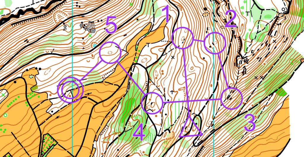
  1. Start a course setting project, open a background map and draw a course.

2. In your course setting project, go to menu DEM > Open and open your terrain model (* _DTM.ocdDem). This file is generated during the LiDAR processing.

3. Now draw a line with the optimal route from start to finish. This has to be done for each course. Use any line symbol in the symbol box or create a new one.

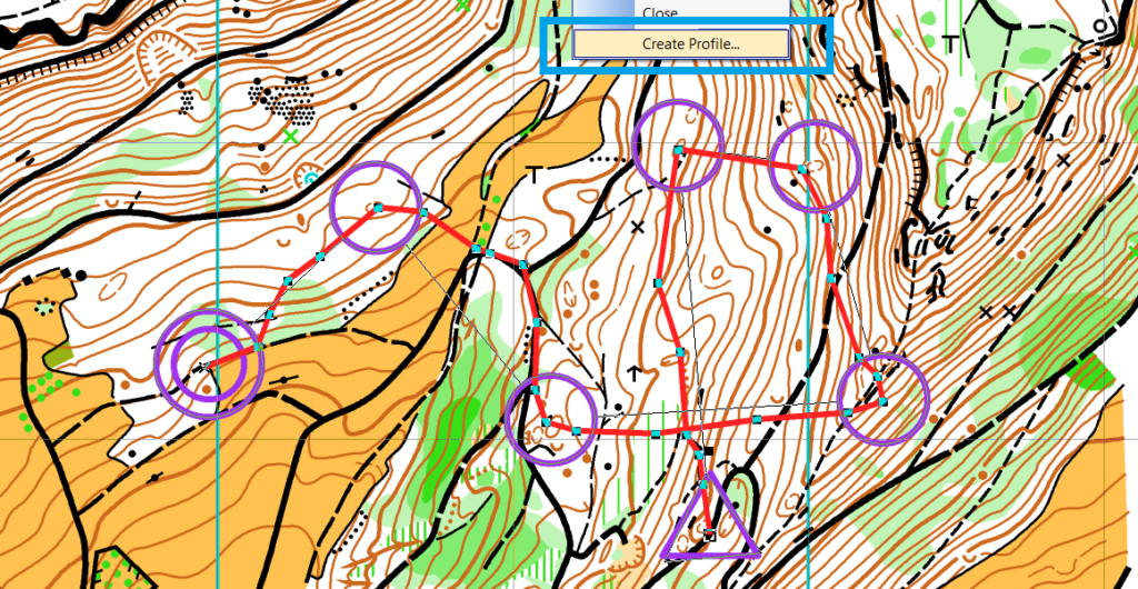
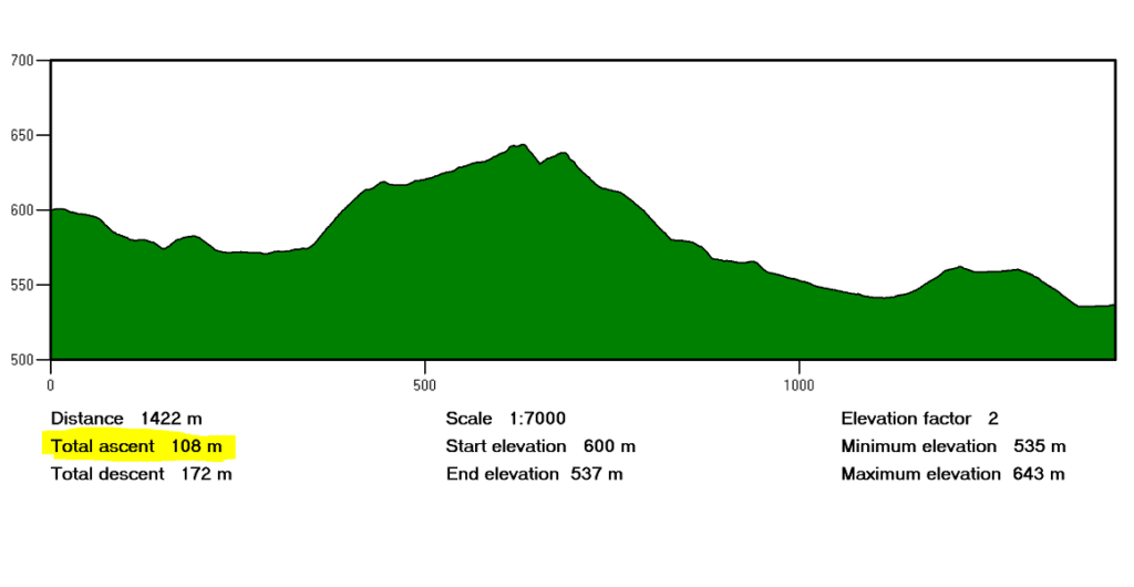
4. Select one of these optimal routes and go to menu DEM > Create Profile. You will get a Total ascent value, which you can enter into Course Setting > Courses > Climb used.

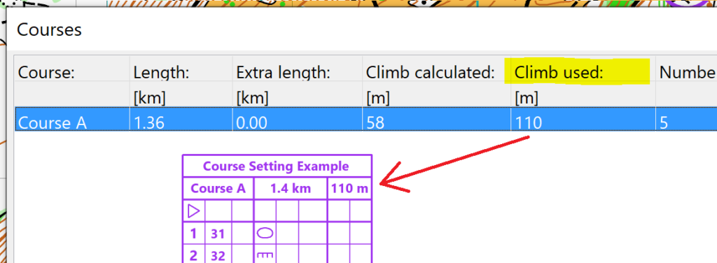
In the Courses dialogue, there is also a Climb calculated value, which is just calculated automatically by adding the net ascent from each control to the next one. The value that is entered in Climb used will show up in the control description.

MapAnt Switzerland is Online

MapAnt Switzerland is an automatically generated orienteering map that should cover the whole of Switzerland in the near future. As a pilot project, the region of north-western Switzerland was calculated. To map all parts of Switzerland, we depend on free and freely available LiDAR data, which are not yet available in all cantons. However, this should be the case in near future.

The map tiles were created in OCAD. Contour lines and a vegetation map were derived from LiDAR data. Also, data from the official cadastral survey were imported and converted into OCAD symbols. Afterwards, WMTS tiles were exported and made available on the web with leaflet.

More about the MapAnt Switzerland project can be found in our Wiki.

Credits: MapAnt Switzerland was inspired by various similar projects worldwide and got financial support by OL Gönnerclub. Thanks a lot!

One-Click Map on a new level

For many years, a vision of OCAD has been to create a usable orienteering map with just one click.

With the latest OCAD Update we have come a step closer to our vision.

Thanks to freely accessible geodata, excellent maps for Switzerland and Finland can be created with the New Map Wizard. The trend towards freely available geodata can also be observed in other countries and we hope to be able to include these countries in the function as well in near future.

Video examples:

More information is available in the OCAD Wiki. The whole auto-generated Jukola 2020 Map Rovaniemi can be downloaded here.

Note: The geodata import for Finland and Switzerland is still a Beta version. Feedback is welcome.

Extract of auto-generated map from Jukola 2020 in Rovaniemi.
Extract from auto-generated sprint map of Baar.

OCAD ThematicMapper «Prix Carto» Newsletter

OCAD ThematicMapper «Prix Carto» Newsletter is also available as a PDF document:
https://www.ocad.com/newsletter/OCAD_newsletter_2015-12.pdf

Please exceuse the missing link in the newsletter for the video about creating thematic maps with OCAD XML Scripts:

Create Thematic Maps with OCAD ThematicMapper

Create Thematic Maps with OCAD ThematicMapper and XML Scripts