At most orienteering trainings and competitions it is customary to survey the control locations in the field before the event and occasionally update the map near the controls.
We’ll show you in this video how to make the best use of OCAD.
Avoid extra work: Use geoservices in advance
There is lot of geodata available, that helps you to get a nice first impression of the terrain, even if it is unknown to you as a course setter.
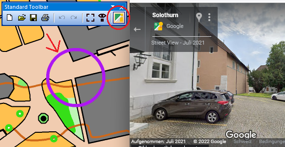
E.g. for spint courses in urban areas, the GeoViewer function in OCAD opens Google Street View (or another GeoViewer Service) at the indicated location. This makes it possible to estimate whether a control can be set or not.
Thanks to WMS/WMTS or Online Map Services, it is possible to load survey data or aerial photographs and check whether new buildings (urban) or clear-cuts (forest) are visible.
The use of all these geo-services is of course dependent on their up-to-dateness and a terrain inspection is nevertheless required. However, a quick check with this tool can save a lot of extra work.
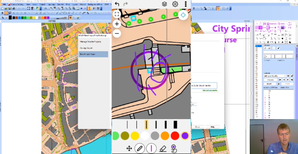
Check control sites with OCAD Sketch App
Now when you go to check the control locations in the terrain, the OCAD Sketch App is highly recommended.
You can download the OCAD Sketch App for free on your mobile device (Android smartphone/tablet or iPhone/iPad) and load your courses on it.
This has two big advantages:
- The GPS position gives you additional security in the terrain whether you are at the right control site or not.
- You can capture map corrections and notes on your mobile device for yourself or send them directly to the controler, map maker or event adviser.
Watch the video Check Control Sites with OCAD and let you explain the steps above.